Subterra
Subterra
Subterra
We're Subterra Ai. We develop custom AI solutions for innovative companies.
We're Subterra Ai. We develop custom AI solutions for innovative companies.
We're Subterra Ai. We develop custom AI solutions for innovative companies.
Subterra
Subterra
Subterra

You
8:15 AM
Schedule a Google meeting with John for 3:45PM tomorrow!

AI Assistant
8:15 AM
I've successfully scheduled a Google meeting with John for 3:45PM tomorrow.

Google Meet with John

Message Subterra Ai …


You
8:15 AM
Schedule a Google meeting with John for 3:45PM tomorrow!

AI Assistant
8:15 AM
I've successfully scheduled a Google meeting with John for 3:45PM tomorrow.

Google Meet with John

Message Subterra Ai …

Chatbot Development
We develop intelligent chatbots that leverage advanced NLP to elevate customer interactions and streamline your business processes.

You
8:15 AM
Schedule a Google meeting with John for 3:45PM tomorrow!

AI Assistant
8:15 AM
I've successfully scheduled a Google meeting with John for 3:45PM tomorrow.

Google Meet with John

Message Subterra Ai …

Chatbot Development
We develop intelligent chatbots that leverage advanced NLP to elevate customer interactions and streamline your business processes.

You
8:15 AM
Schedule a Google meeting with John for 3:45PM tomorrow!

AI Assistant
8:15 AM
I've successfully scheduled a Google meeting with John for 3:45PM tomorrow.

Google Meet with John

Message Subterra Ai …

Chatbot Development
We develop intelligent chatbots that leverage advanced NLP to elevate customer interactions and streamline your business processes.
Privatized Hosting
You don't want your private data online and neither do we. Thats why our systems our private to only you and your company
Privatized Hosting
You don't want your private data online and neither do we. Thats why our systems our private to only you and your company
Privatized Hosting
You don't want your private data online and neither do we. Thats why our systems our private to only you and your company
500+
Automations
500+
Automations
Workflow Automations
We automate your workflows to streamline repetitive tasks, enhance efficiency, save time, and eliminate errors.
500+
Automations
Workflow Automations
We automate your workflows to streamline repetitive tasks, enhance efficiency, save time, and eliminate errors.
500+
Automations
Workflow Automations
We automate your workflows to streamline repetitive tasks, enhance efficiency, save time, and eliminate errors.
Write your prompt…
What should my company do?


Is it safe to put company secrets in ChatGTP?
No. Never
Write your prompt…
What should my company do?

Is it safe to put company secrets in ChatGTP?
No. Never
LLM Development
We develop Large Language Models that transform how your company interacts with data and customers.
Write your prompt…
What should my company do?


Is it safe to put company secrets in ChatGTP?
No. Never
LLM Development
We develop Large Language Models that transform how your company interacts with data and customers.
Write your prompt…
What should my company do?


Is it safe to put company secrets in ChatGTP?
No. Never
LLM Development
We develop Large Language Models that transform how your company interacts with data and customers.
Cost -67%
Efficiency +103%
Cost -67%
Efficiency +103%
AI Consulting
Our experts provide strategic guidance, enabling your business to implement AI solutions that drive transformative growth.
Cost -67%
Efficiency +103%
AI Consulting
Our experts provide strategic guidance, enabling your business to implement AI solutions that drive transformative growth.
Cost -67%
Efficiency +103%
AI Consulting
Our experts provide strategic guidance, enabling your business to implement AI solutions that drive transformative growth.
The process


01
Analyze
We start with a thorough analysis of your current workflows to see how AI could improve your processes.


01
Analyze
We start with a thorough analysis of your current workflows to see how AI could improve your processes.


01
Analyze
We start with a thorough analysis of your current workflows to see how AI could improve your processes.
1 <html lang="en">
2 <head>
3 <meta charset="UTF-8">
4 <meta name="viewport"
5 content="width=device
6 width, initial-
7 scale=1.0">
8 <title>Halo</title>
9 <style>
10 body {
11 font-family: Arial, 12 sans-serif;
13 background-color:
14 #f4f4f9;
15 color: #333;
16 margin: 0;
17 padding: 0;

Subterra
HTML
React
CSS
1 <html lang="en">
2 <head>
3 <meta charset="UTF-8">
4 <meta name="viewport"
5 content="width=device
6 width, initial-
7 scale=1.0">
8 <title>Halo</title>
9 <style>
10 body {
11 font-family:
12 Arial, sans-serif;
13 background-color:
14 #f4f4f9;
15 color: #333;
16 margin: 0;
17 padding: 0;

Subterra
HTML
React
CSS
02
Build & Implement
Then, our developers will start crafting custom AI-solutions for your company, continuously prioritising quality and safety.
1 <html lang="en">
2 <head>
3 <meta charset="UTF-8">
4 <meta name="viewport"
5 content="width=device
6 width, initial-
7 scale=1.0">
8 <title>Halo</title>
9 <style>
10 body {
11 font-family:
12 Arial, sans-serif;
13 background-color:
14 #f4f4f9;
15 color: #333;
16 margin: 0;
17 padding: 0;

Subterra
HTML
React
CSS
02
Build & Implement
Then, our developers will start crafting custom AI-solutions for your company, continuously prioritising quality and safety.
1 <html lang="en">
2 <head>
3 <meta charset="UTF-8">
4 <meta name="viewport"
5 content="width=device
6 width, initial-
7 scale=1.0">
8 <title>Halo</title>
9 <style>
10 body {
11 font-family:
12 Arial, sans-serif;
13 background-color:
14 #f4f4f9;
15 color: #333;
16 margin: 0;
17 padding: 0;

Subterra
HTML
React
CSS
02
Build & Implement
Then, our developers will start crafting custom AI-solutions for your company, continuously prioritising quality and safety.
Update

Update available
+8%
Security
-11%
Operational cost
+25%
Workflow efficiency
+38%
Software speed
Update

Update available
+8%
Security
-11%
Operational cost
+25%
Workflow efficiency
+38%
Software speed
03
Maintain & improve
After deployment, our team will keep working hard by providing support and continuously improving the implemented solutions.
Update

Update available
+8%
Security
-11%
Operational cost
+25%
Workflow efficiency
+38%
Software speed
03
Maintain & improve
After deployment, our team will keep working hard by providing support and continuously improving the implemented solutions.
Update

Update available
+8%
Security
-11%
Operational cost
+25%
Workflow efficiency
+38%
Software speed
03
Maintain & improve
After deployment, our team will keep working hard by providing support and continuously improving the implemented solutions.
Meet our Leadership
Projects

Enterprise Network Observability Platform for a 1,500-Device Infrastructure
Enterprise Network Observability Platform for a 1,500-Device Infrastructure
We engineered a tailored network monitoring solution that transformed a 1,500-device environment into a fully visible, data-driven operation.
Learn More ...

Subterra GeoIQ
Subterra GeoIQ
AI-Powered Geotechnical Bore Report Intelligence Platform
Learn More ...

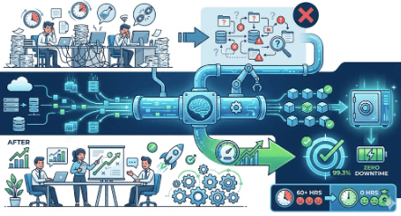
Eliminating Manual Data Work With Subterra’s Agentic AI Pipeline
Eliminating Manual Data Work With Subterra’s Agentic AI Pipeline
Case Study — Eliminating Manual Data Work With Subterra’s Agentic AI Pipeline
Learn More ...

Enterprise Network Observability Platform for a 1,500-Device Infrastructure
We engineered a tailored network monitoring solution that transformed a 1,500-device environment into a fully visible, data-driven operation.
Learn More ...

Subterra GeoIQ
AI-Powered Geotechnical Bore Report Intelligence Platform
Learn More ...

Enterprise Network Observability Platform for a 1,500-Device Infrastructure
We engineered a tailored network monitoring solution that transformed a 1,500-device environment into a fully visible, data-driven operation.
Learn More ...

Subterra GeoIQ
AI-Powered Geotechnical Bore Report Intelligence Platform
Learn More ...

Eliminating Manual Data Work With Subterra’s Agentic AI Pipeline
Case Study — Eliminating Manual Data Work With Subterra’s Agentic AI Pipeline
Learn More ...
Answers
Answers
Answers
We've gone ahead and answered some of the questions you might have.
What makes your AI company different from large, national providers?
Do you offer custom AI models for specific business needs?
Is our data secure and private with your solutions?
What industries do you serve?
Can we talk to a real person, or is everything automated?
What’s the first step to working with you?
Let's talk!
Office:
7845 Hwy 1 Mansura, Louisiana 71350
Local time:
7:33:42 AM
Subterra
Subterra


