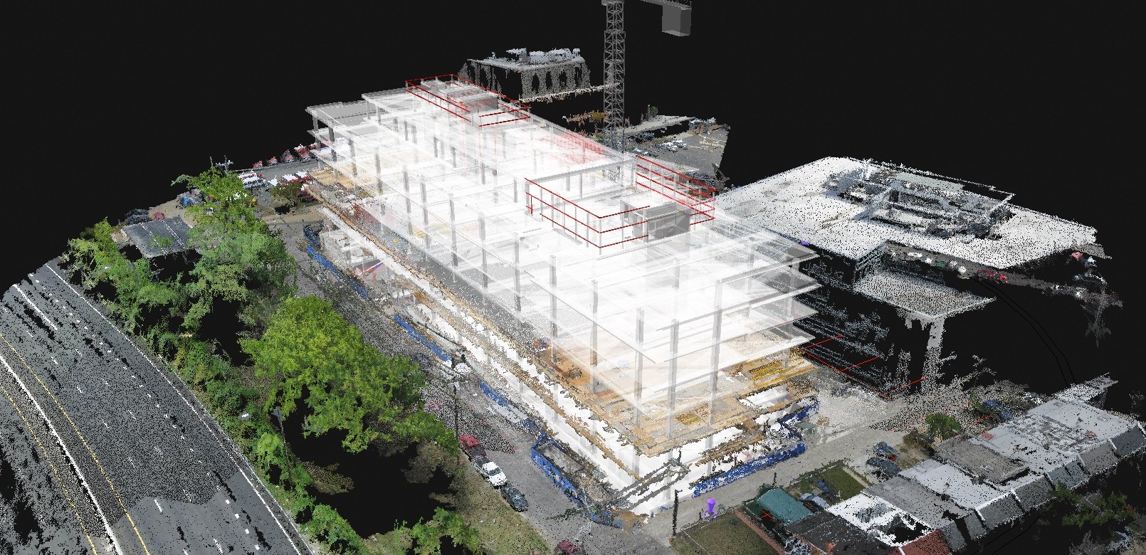
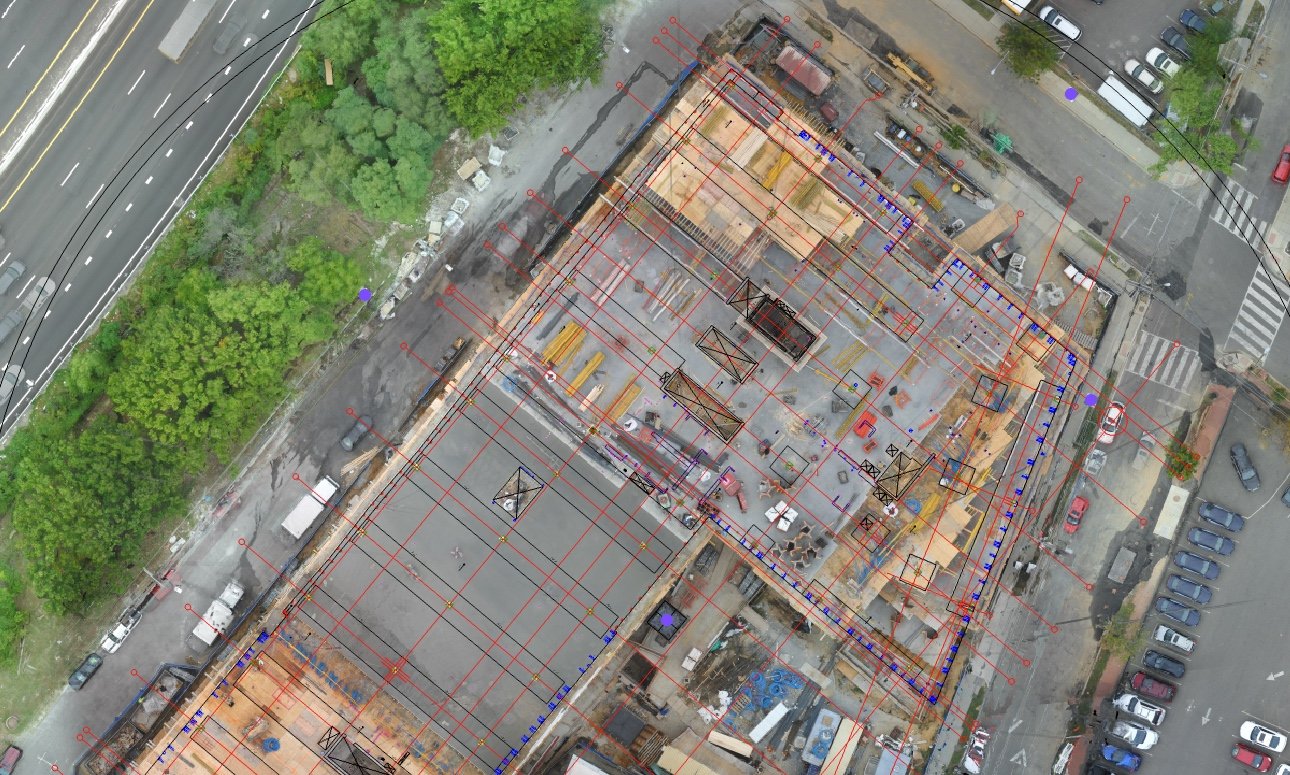
LIDAR + Photogrammetry
Subterra Technologies leverages state-of-the-art aerial LiDAR to deliver precise, high-resolution data tailored to any project size. Our expert analyses provide clear, actionable insights quickly and efficiently.
Our LiDAR Services Include but not limited to:
Construction & Earthmoving: Accurate cut-and-fill calculations.
Utility & Powerline Management: Risk assessment, clearance checks, and growth modeling.
Forestry Management: Biomass calculation and tree canopy analysis.
Hydrology & Watersheds: Drainage mapping and floodplain modeling.
3D Modeling: Precise digital twins and site reconstructions.
High-Resolution Imagery: Sharp, up-to-date aerial photography.
Virtual Site Walkthroughs: Immersive simulations for project planning.
Infrastructure Monitoring: Regular inspections for preventative maintenance.
Whether for infrastructure, agriculture, construction, or environmental projects, Subterra's aerial LiDAR solutions deliver insights that drive confident decisions.
Contact us today to learn more!
Try our custom online viewer